Rotterdam’s manufacturing: a brief history
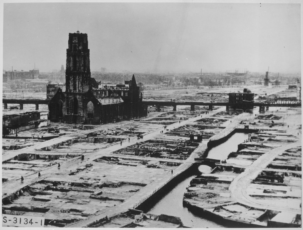
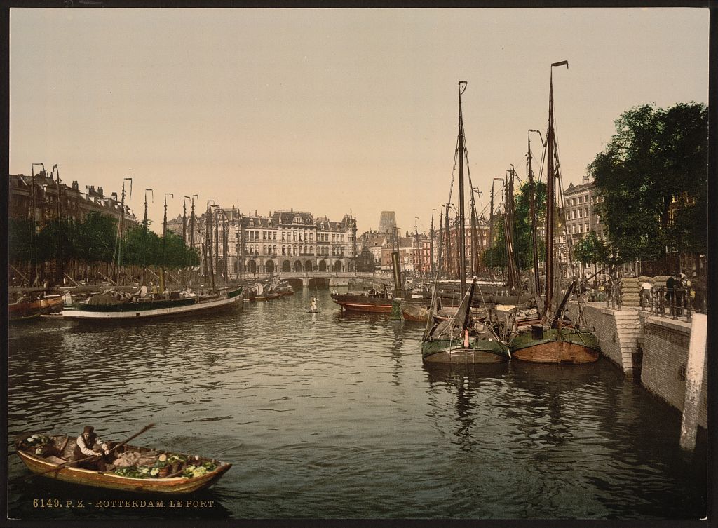
The embankment, Rotterdam, between ca. 1890 and ca. 1900. © The Library of Congress
Rotterdam’s manufacturing has grown out of its two definable industries: the port and agriculture. As the port grew, so did ship building and process of the resources that arrived at the port. Agriculture on a small but highly productive landscape generated a speciality in food based technology.
Two Landscapes, Two Economies
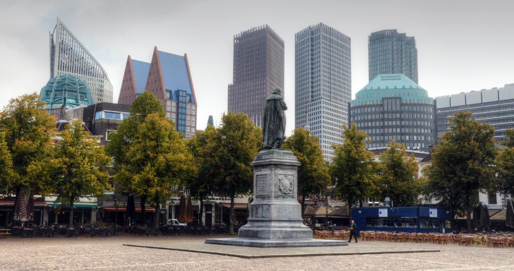
Rotterdam and The Hague were born on two waterfronts: Rotterdam has grown along the river towards the North Sea and The Hague on the old dunes parallel to the coast that housed nobility, high bourgeoisie and civil servants. They have been connected by parallel forms of infrastructure since the fourteenth century, including canals, railways, motorways, and metro. If Rotterdam’s economic character has been historically dominated by its port, The Hague’s has been a center of government of and diplomacy. The combination has resulted in an internationally trade focused region with Europe’s largest port and most intensive agricultural area.
Industrial Past and Present
The recent history of industrial development in the Rotterdam-The Hague region is inextricably linked to the port of Rotterdam. Beginning in the late 19th century, the port of Rotterdam transitioned from functioning under a staple market system to being a modern port; it ceased to base its activities in the exchange of high value commodities and specialized on the throughput of bulk and raw materials, and later to additional port-related industries, such as shipbuilding. Eventually, Rotterdam itself transitioned from a mercantile town (where a handful of merchant families were key in orienting the development of the city and market) to an industrial town. It shifted from having a mix of industry, trade, and socio-economic functions, to becoming dominated by a strict separation of functions2.
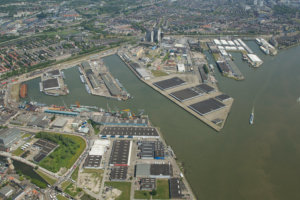
The growth of the port that followed in the first half of the 20th century was dramatic. The reasons for this were threefold. Firstly, the construction of the Nieuwe Waterweg in 1872 linked Rotterdam directly with the North Sea and enabled access to the port of Rotterdam for larger ships. Secondly, innovations in water and land transportation, were suited to the city’s geography or resulted in the city adapting itself to the new technology. Finally, Rotterdam rose in the wake of Germany’s late 19th and early 20th century industrial euphoria. The port grew from 200 Hectares in 1880 to 1,880 forty years later.3 In parallel, Rotterdam grew linearly along the river, flowing westwards following the growth of its port4.
Rotterdam, Functionalist PortCity
Second World War and subsequent reconstruction were a turning point in the port and city dynamics. The city saw some 2.6 km2 of its medieval centre and other areas levelled by German bombs while the port suffered the destruction of seven kilometers of quay walls and a loss of 40 percent of its warehouse area5. By 1950, the port had receded to 1,400 Hectares6.
Guided by the Basis Plan of 1946, reconstruction was based on the modernist principle of functional separation7. “First the port, then the city” became the motto behind Rotterdam’s economic revival8. Following on the modernist logics, what happened in the port had its own logic. Obviously, given the scale of the port, and the focus on water based traffic, that had huge effects in the city’s economic profile and in its notably less diversified industrial development9. Historically, the port has behaved as a ‘landlord’ port, which leases sections of its premises and supplies with infrastructure to those companies that align with the Port Authority’s strategy; the emphasis on throughput of cargo has therefore limited the type of industries that could settle by the River Maas.10
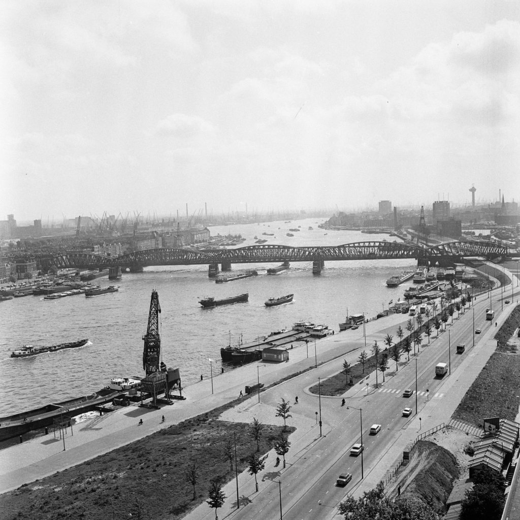
In the postwar, the port continued focusing on being a hub for transit and distribution. Investments in waterways and wharfs made room for larger vessels and newly invented containers11. Before 1940, 70 to 75 percent of goods were merely in transit. The realisation in the 1980s that “barely anything was done with the goods [that came in the port] in Rotterdam” led to define strategies to diversify its economy and focus on developing added value12, making it less dependent on cargo and taking advantage of the port’s location while creating new employment13. Initially oil refineries and chemical industries were built14, followed by an emphasis on supply chain management and intermodal platforms which regionalised the port’s economy.
Urban Renewal in Rotterdam
If the dominance of the port in spatial politics was hampering the development of a diversified economy in the large, regional scale, policies of urban renewal in the 1970s and 1980s razed the remaining productive urban ecologies in the inner city. Housing shortage in the 1960s and early 1970s was aggravated by businesses competing for central land. In the period between 1970 and 1974, some 1200 dwellings were occupied by businesses due to the lack of available space.
The urban renewal projects substantially reduced the available space for making via regulation and urban design. Firstly houses were prevented from being transformed into office space. Secondly retail structure was pushed onto high streets to avoiding scattered shops in residential areas. Finally industrial spaces causing nuisance were moved out of the neighbourhoods.
The consequence was a sharp reduction of local jobs and working environments: – 11 percent reduction of local jobs compared to -0.7 percent in overall Rotterdam. Urban renewal resulted in a surprising paradox in Rotterdam’s business landscape: while the supply of business space was twice as the demand, there was a shortage of smaller business premises; large companies had left, smaller ones remained, and new, smaller companies could not afford the new rents.
Challenges and Transitions
The port has continued its voracious growth in the past 40 years: from 7,600 Hectares in 197916, to 12,600 in 201717. This growth exacerbated the inherent conflict between the spatial logic of the port versus that of the city18. As the port kept its position as global actor and distanced itself spatially from Rotterdam, the inner city was neglected: it was, and remains, a relatively poor city, with lower incomes, higher unemployment, lacking good public space, containing fractured communities and cultural life19. As the city has extended along the banks of Rotterdam’s waterways to the North sea, it has split the whole region in two parts20 and has hindered the creation of a shared identity21 while creating social divisions.
In the 1990s, the politics of “if the port is successful, Rotterdam is successful as well” continued22, the sums didn’t add up. Indeed, the economy of the city is dominated by the port, and the income of the municipality is tightly linked to the number of ships docking there and the volume of goods handled. It is the biggest job provider in the city: 85,000 in 2016 with about 250,000 people employed within the maritime economy.23 In short, the economic spillover of the port in the city is in doubt due to further automation and reduced demand for low skilled jobs.
The most recent strategy focuses on creating a ‘knowledge port’ by fostering knowledge and innovation-related industries, attracting well-off creative and knowledge workers24, while being oriented towards the city rather than the sea. The port is now seen as a source of innovation, where multinational firms and knowledge and innovation clusters interact, with a strong accent on maritime industry25, steered by the Port Authority to transition to sustainable transport, clean energy, and, most of all, the greening of its activities26. This strategy is seen to attract partners, investors, and high skill labour27. Furthermore, the strategy includes waterfront redevelopment linked to the economic diversification and mix with other uses – particularly development of housing and public space28.
The region’s knowledge economy is quite sizeable and therefore an opportunity, including two large universities (Erasmus University in Rotterdam and TU Delft), three hogescholen (schools of applied sciences), and other academies, enrolling more than 100,000 students. An array of additional knowledge institutions such as the academic hospitals, TNO (Netherlands Organisation for Applied Scientific Research) and Deltares (a large technology institute focused on delta engineering). Workers in this knowledge network live across four cities – Delft, Leiden, Rotterdam, and The Hague. Greater spatial coherence, more interaction and better conditions for supported facilities, could be important ingredients of future spatial policy in the region.29
Today, the pressure to build more housing, and the focus on very specific industrial sectors in the industrial agendas of both port and governments, limit the possibility of achieving a diverse economic system, specially urban manufacturing. The port is redeveloping waterside areas into business sites aligned to its innovation agenda, mainly belonging to the maritime sector and sets out a strict set of requirements for businesses to settle in available land. Furthermore, on these portside redevelopment areas controlled by the municipality, the pressure for building new housing – the city needs to build 40,000 new homes – is putting in risk very young productive ecologies that had settled in marginal, underused industrial areas. As Paul Stouten has noted, urban regeneration and housing construction is moved by the political aim of attracting creative or higher income groups, and gentrifying the inner city of Rotterdam to make it attractive for investors30 therefore increasing prices per square metre and making it less accessible for small making and manufacturing businesses.
The adapted delta for the future industrial landscape
The rise of an industrial economy in the Rotterdam-The Hague region is a result of the ability to adapt and exploit the landscape to the technical demands of the time – this interdependency is unique and is vulnerable to the adaptability of the port to climate change and requires a brief summary to show some of the variables at play.
Rotterdam grew out of its favorable position at the estuary ‘Nieuwe Maas’, atf the river-mouths of the Meuse and Rhine. The landscape was the product of the processes of sediment-transport by rivers and sea, resulting in an alluvial landscape of soft clay and peat. Urbanization of these deltaic marshlands was possible by applying a centuries-old land-making technology: draining the highest parts of the alluvial territory, and surrounding the drained territory with dikes for protection against high water events in the river and/or sea. This combination of drainage and dike-construction resulted in the typically Dutch polder-landscape and polder-cities. Ongoing sediment-transported by rivers and the sea resulted in new land outside the dikes, which could be reclaimed by repeating the same process: draining the new silted-up territory and constructing new dikes around it. This type of colonisation of the land took maximum profit of the ‘ecosystem services’31 of the estuary landscape, using the natural processes of currents, transportation of sediment, siltation and the role of vegetation.
This dynamic process changed radically from the 19th century, as a result of the introduction of new technologies of land-making and river-management and the rise of the industrial economy32. The Nieuwe Waterweg and, later, the construction of the large scale port areas of Botlek, Europoort and Maasvlakte resulted in a radical transformation of the existing polder- and river landscape to a completely new, artificial port-landscape of 12,000 hectares. Villages and farms were evacuated and demolished, polders and dikes were excavated, harbor-basins dug out, new land constructed artificially, a new river mouth (Nieuwe Waterweg) deepened by dredging from 6 meters (1880) to 16 meters currently. Ecosystem services were not used anymore; instead, they were denied and ruined.
The making of this new landscape influenced the physical conditions of the city dramatically. Dredging, narrowing and deepening the river mouth resulted in an increased influence of the sea in the urban areas: stronger tidal dynamics, increased impact of storm surges and increased salinisation of river- and groundwater. Consequently Rotterdam had to adapt the flood protection system, including higher dikes and building a series of new storm surge barriers (Maeslant Barrier, Hartel barrier and Hollandse IJssel barrier), and developing special systems for fresh water supply.
Now a large part of the landscape sits somewhere below or just above sea-level, rendering a vast area of the productive landscape exposed climate change. How will it face climate change and deal with rising sea levels and increasing peak discharges of rivers? The region needs a radical spatial reorganisation. In the national Delta program, launched in 2015, two main options are presented: 1) raising the current dike system, and changing the fresh water supply system or 2) closing the New Waterway with a new barrier, and directing the river to discharge completely into the Haringvliet (south of Rotterdam). An alternative 3rd option of totally reorganising the river-mouth area into a more ‘natural’ tidal river landscape. It has been considered too radical and too damaging for the established economic interests.
All options will have tremendous consequences, giving either more or less space to manufacturing in the harbour areas or changing accessibility to a large part of the port which will relocate the deep sea port to outside the new sluice. All three options should be considered seriously as they will play an important role in the transformation of the industrial economy to the ‘Next Economy’, as will be discussed later in the chapter.
This text was first released within the ‘The Cities Report‘.